
 |
| young ladies checking out the snacks shop on the ferry |
We took a Malaysian train to the Thai border and then had to wait several hours for the Thai train to Bangkok. We struck up conversation with fellow waitees: a US expat living in Bali, a Chinese tourist/IT student and a Japanese tourist. We bought each other beer from the duty free shop in the station.

There is very little coordination between the two countries' train service. T and I went to great lengths to secure a first class (= private) sleeper on the overnight train. We had to buy two separate tickets and have the Thai ticket delivered by courier to our Malaysian address. Though not luxurious, the first class compartment was very comfortable.
Seen in the Bangkok train station:

We happy tourists stayed one night in Bangkok with friends who had just moved there from Penang, from a taxi there I spot a truck with large lettering on the side "Yamazaki" (a Japanese name) with a picture of a Western girl of 6 - 8 years, in pigtails, eating [Yamazaki brand] white bread. Brain cramp!
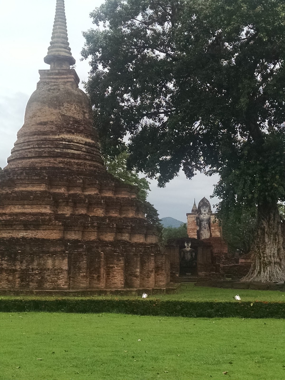
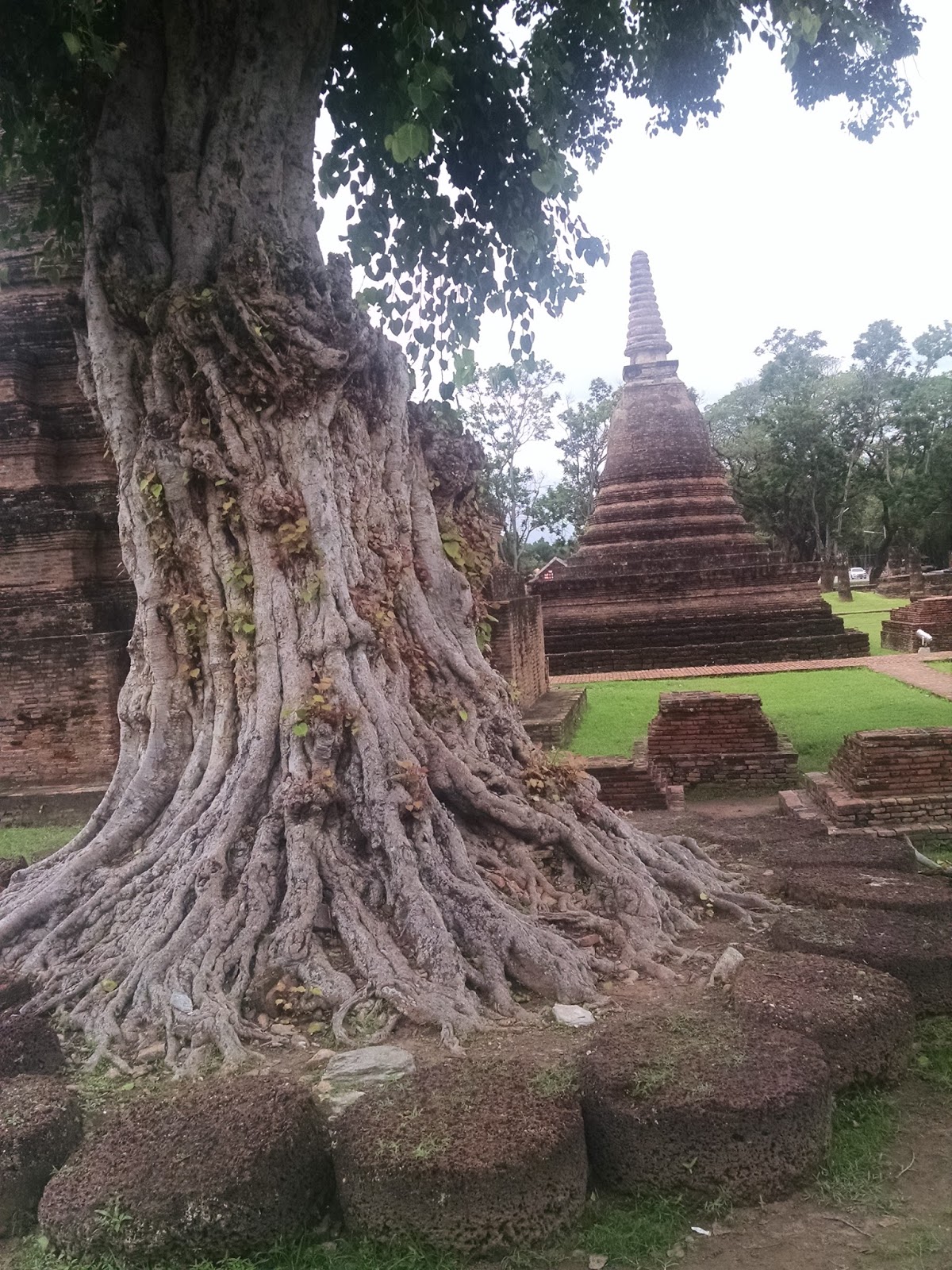
It was a short flight to Sukothai. "Old" Sukothai is a UNESCO world heritage site dating from the 13th century. It was part of the Khmer empire until 1288 when two Thai rulers formed a kingdom that lasted 200 years. Sukothai Historical Park's main area is spread out over a 5 kilometer (3 mile) radius. Visitors are advised to bicycle or hire a car. We walked, K on her new foot. It was fine--we took it slow, and stopped periodically. Lovely area, sites (temples) quite spread out, relatively few visitors. We were impressed with the variety of architecture--much more varied than those at Angkor Wat. Much of it is in ruins but what remains includes Hindu, Khmer and Singhalese (think Sri Lanka) styles. Sukothai is a style in it's own right and includes walking Buddha images. lotus bud chedi, lines of elephants around chedis, and Budhha images in four styles: walking, standing, sitting and reclining, each facing a different direction.


 |
| detail of an enormous Buddha figure at Wat Si Chum. T asks who his manicurist is... |

 |
| elephants |


The next day we hired a tuktuk for two hours, to go to some of the farther out places. The first stop was Wat Saphan Hin, about four km west of the old city and accessed by climbing a stone path and stairway. Beautiful colors of stone. There is a standing Buddha at the top and a nice view of the countryside.


We were able to see around two dozen wat ruins to the west and south of the walled city as we putt putted by, including the above Saphan Hin.


 |
| Wat Ma Muang |
T's favorite was Wat Chetuphon, with remains of a four-sided Buddha figure--walking, standing, sitting and reclining, one on each side. Only the walking Buddha is still easily visible, but you can tell the others by the shape of the remaining brick work that underlays the statues. We saw this at many of the sites--brickwork, with some kind of plaster on top.
 |
| walking Buddha |
Also at Chetuphon are remarkable stone walls and archways, held together by mortise and tenon cut into the stone.


Back at the hotel:


And at the Sukothai Museum, we find a family tree!
Within the old city walls, an active wat on an island in a small lake:


 |
| Buddha footprint inside the wat |
After Sukothai we rented a car in nearby Phitsanulok and set out for "the alps of Thailand" and Loei Province. Leaving Phitsanulok, we spot one of those "Never in America" sites, a large store:

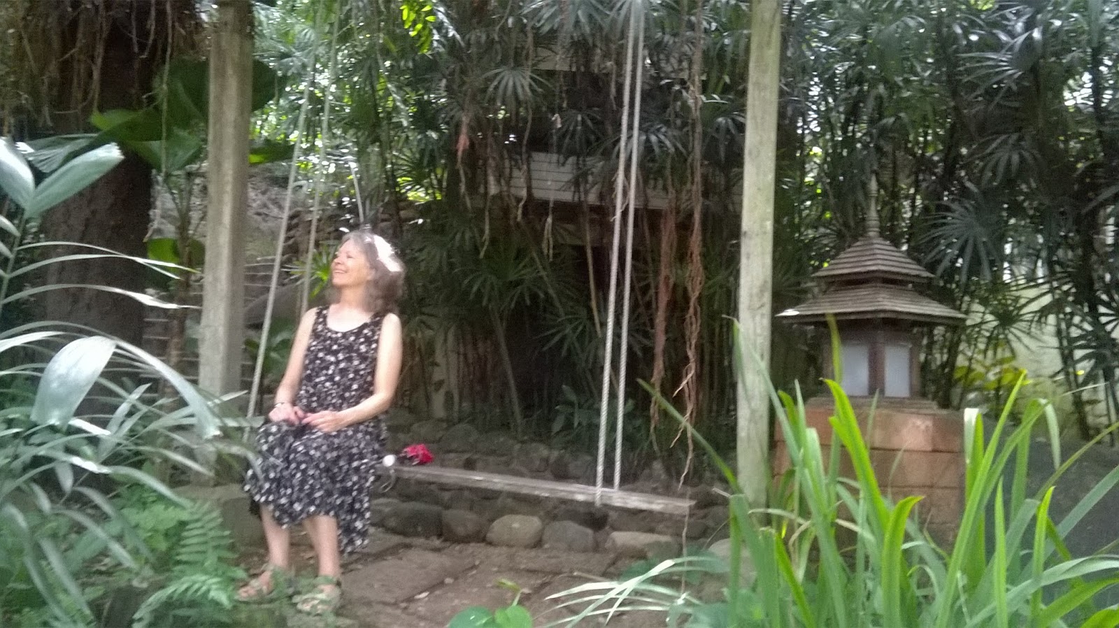
We had booked two nights at the Rainforest Resort along scenic Highway 12, and left two nights after that open for adventure, mainly owing to the lack of online information (in English anyway) on accommodations. Rainforest Resort was an amazing oasis right off the four-lane highway. Here is K enjoying a wooden swing by the river.
We did a day trip from there to Phu Hin Rong Kla National Park, gulped at the 500 Baht per foreigner entrance fee (US$14) plus car fee, but enjoyed a 3.5 km hike that featured both very cool, unusual rock formations and remnants of the former outpost of the Thai Communist Party.
 |
| the path! |
 |
| nature-made! |


 |
| K's new toe, and rocks |

So odd it didn't seem natural...but was/is.
Here is the rebels' "air raid shelter":


and the former prison, listing to the right...

And there were some waterfalls in the park. Saw this bad boy on a trail to one of them:

One night at the Rainforest Resort we had a river view room. Here is the view from our balcony:

And here is the shower :-)

T enjoys wild boar at the restaurant there

On toward Loei Province, along the so-called Green Route of Highway 12. We visited Nam Nao National Park, and had a hike to a waterfall. The air was very still through a bamboo forest--a relief to get back out to the road and some air. Here is the waterfall (Sai Thong, I think):

We were on the lookout for a place to stay, having heard there were several near Nam Nao, which we did not find to be the case. Nearing Kohn San, T spotted an outline of a camel and quickly pulled over. Huh?, thought K. Camels, oasis, rest stop, and we had found a wonderful motel for the night! Each room was a different style, ours quite ordinary but very comfortable, with AC, TV and fridge. Free hot drinks in the morning. But T made his own espresso (thanks, Cam for the apparatus!).

Sweet lady who dealt with our massacred Thai language and served us dinner--T thought she might have overcharged us, at 210 Baht/$6 including beer.

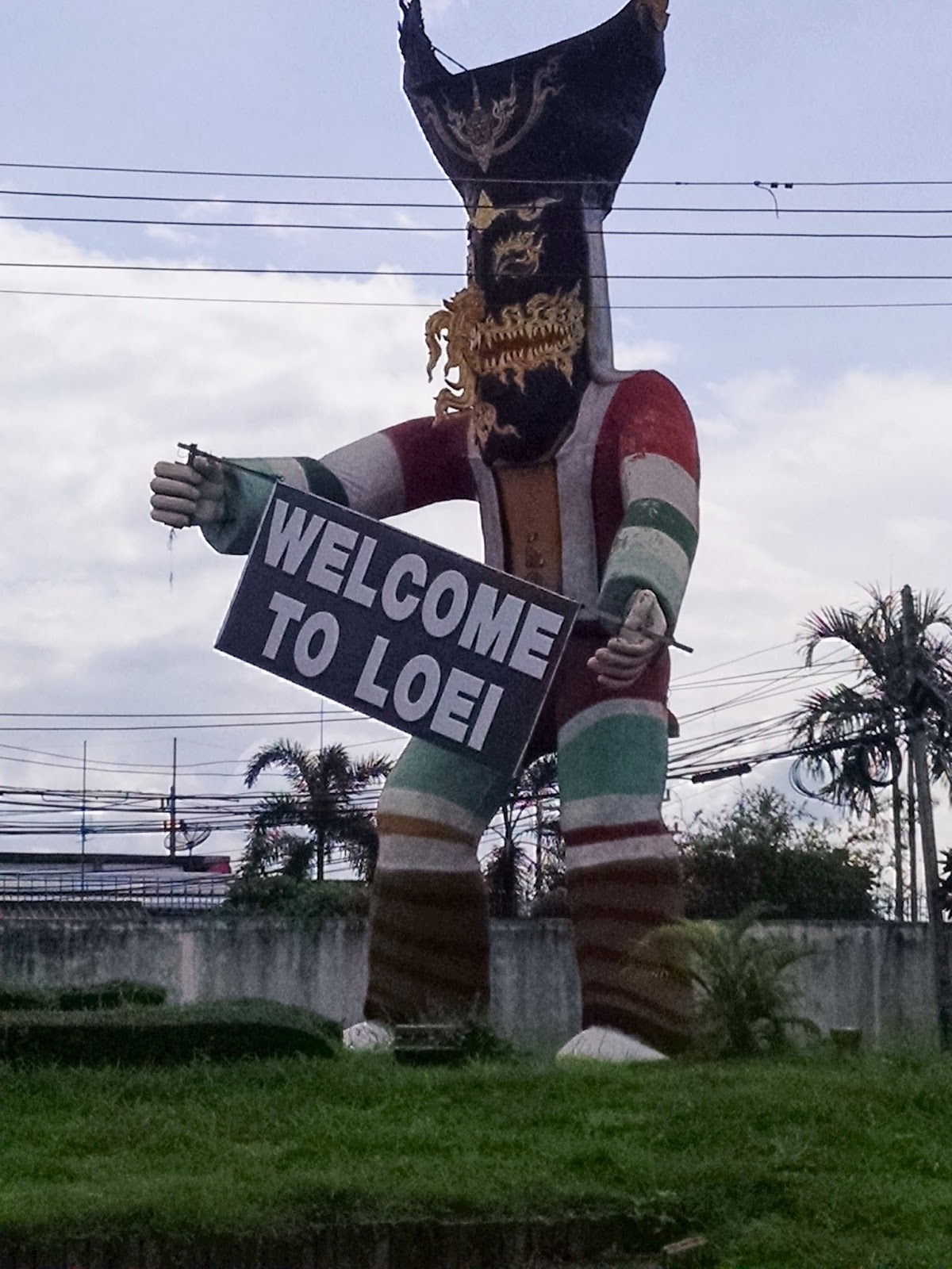
Welcome to Loei, where hardly any farang go.
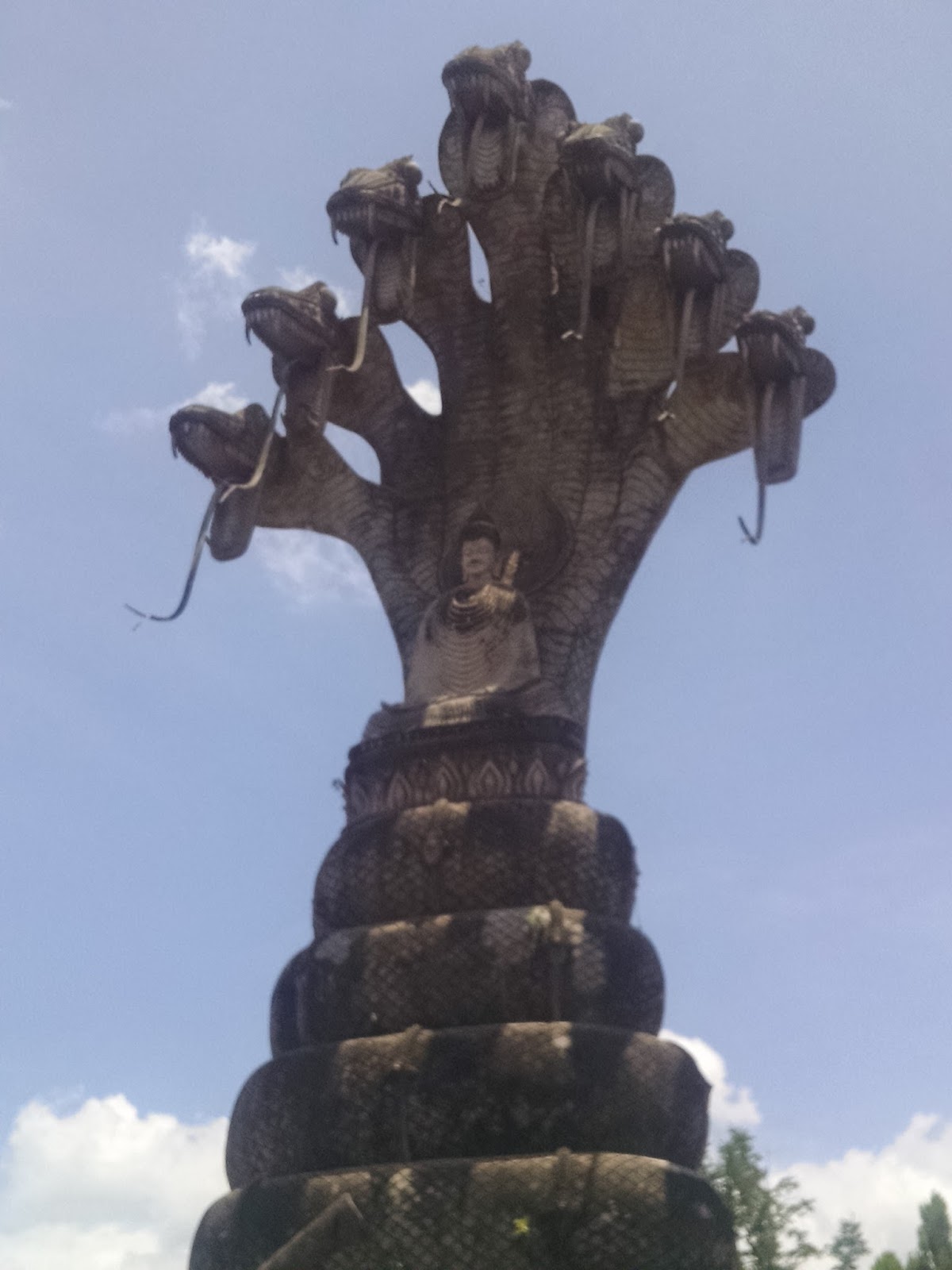
Along the road in Loei Province:

We were on the trail to find a stone maze (!) K had read about, a place known as the Kunming of Thailand for its dramatic rock formations. A place with no signs in English--well, there was one but it was behind a tree and only sported a left turn indication with no apparent left turn in sight. At a loss, we stopped at a opportunely located cafe and ordered coffee. A really nice place with this on the wall

The proprietor was a teacher...with a barista certificate from Chiang Mai. She drew us a most helpful map to the desired road, and made some terrific lattes. The road is very good, passing through farms and villages

At 15 km we hit the park entrance and the ranger took our picture. No foreigners here for some time, apparently... Another 5 km and we sail by another desired turnoff, eventually turn around and spot the sign that says various things in Thai and then "Kunming" under that. Mind you, Kunming is a place in China and this place is actually called Suan Hin Pha Ngam. Ah well. K has since posted detailed directions on Trip Advisor to possibly aid future ignorant travelers...
We reach a row of shops and a deserted parking area--this must be it. A "spirit dog" appears, and leads us to a stone-studded path. Only then did we see a sign for "Nature Trail." Way to go, puppy! We followed it for awhile, stopped to leave the trail to take a picture of a Buddha statue, wondered what was on the other side of it, and Ta Da--we discovered the stone "maze". Incredible! Crazy rock formations and a beautiful narrow path among and around and through them. And we were completely alone, save our canine companion. We understand that Thai people travel on weekends and holidays and this was neither.


Mainly pictures of K, who was apparently too busy enjoying the place to take photos.
A wonderful place, really. We emerged at the end, which turns out to be the main entrance,. Spirit dog had vanished...


We drive back to the main road, stopping in a village for lunch, in a two-table restaurant that doubles as the post office. We have a terrific noodle soup, and have our photo taken a second time...
 |
| Yum |
Back on the road, we cover some distance and then find a place for the night, a place with a large sign in English: Nimit Paradise. it was fine, but nothing so special as the camel place of the previous night.
The next day we head for our final destination, the town of Nong Khai on the Lao border. We stop on the way at Phu Prabat Historical Park, for more weird rock formations :-). This place, though quite remote, is solidly on the tourist trail, and for good reason. People inhabited this place 2500 - 3000 years ago, and left behind paintings that are still visible


Nice views in one area of the park


Here is a well


In a more recently inhabited area, a Buddha image and sacred area surrounded by stone pillars.


On to Nong Khai, on the Mekong River, roughly across the river from the Lao capital, Vientiane. Very cool for us as we have been on the other side, looking toward this place. The contrast is striking--Thailand is prosperous, Lao is not. Here is the view:


On this side of the river a well maintained and lighted path lines the river the length of the town, several kilometers. On the Lao side, a pitted road that loses all pavement at one point.
We make a pilgrimage to Sala Keku, a weird sculpture park. The man who created it also created an earlier one on the other side of the Mekong, which we have seen. The creator, Luang Poo Boun Leua Sourirat, fled Laos in 1974 at the communists gained power there. He thought they might not appreciate his views We found the Lao side one stranger, with more variety than the Thai version. Still...


The guy is actually buried here. His crypt, lit in green lights:

In the "Never in Malaysia" category, outside a hotel in Nong Khai, magazine racks--English, Thai and gay:

We visit Wat Lam Duan--a wat in Nong Khai right on the Mekong, climbing to the top of an enormous Buddha statue to see the view:


Another wat, Wat Tung Sawang, has a variety of Buddhist deities:


We enjoyed sunsets on the Mekong, and had dinner two nights at a simple restaurant we fell in love with. T went wild for the Isan (northest Thailand) sausages, twice, and K their two fish dishes and sticky rice


Here is the bridge over the Mekong, AKA Thai-Lao Friendship Bridge, built by the Australians in 2007.

We had a terrific view from our guesthouse balcony


At 8:46 pm Laos went dark--lost electricity--for a few minutes. Thailand did not. It came back on a few minutes later.
T on the Mekong

We watched a remarkable, day-long process of lorry after lorry/truck after truck of Thai-made goods being unloaded, carried into a terminal building and pushed down a ramp into boats bound for Laos. Plastic furniture and many assorted goods, one batch labelled " sunscreen with whitener".


Our last evening we sat on the balcony overlooking the Mekong, playing [travel] Scrabble and tuning in Spotify [again thanks Cam] to "chill Music", subcategory "beach"--well, the Mekong makes a kind of beach.